
These days, Tofino’s Long Beach is a year-round hotspot for surfers and young families playing in the soft white sand. But the scene was dramatically different in 1942, when the beach was strewn with barbed wire, cable and other debris to discourage enemy landings by air or sea.
Clean-up efforts in the 1950s removed most of the explosives and other remnants of the Second World War, but hiding in the forest just a few kilometres north of Long Beach there’s another relic still intact.
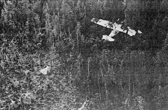
The Canso bomber near Tofino, shortly after it crash-landed in February, 1945. Photo: Pacific Wrecks/RCAF via Larry Niven/Peter Evans
Long after sunset on a February evening in 1945, pilot Ronnie J. Scholes took off from Tofino Airfield in a PBV-1A Canso bomber with 12 crew on board. Within seconds, one of the plane’s engines quit cold and the plane started losing altitude. Quick thinking from Scholes slowed the plane’s crash into the trees, and miraculously, all crew members survived.
Everyone aboard scrambled away from the plane as fuel poured from its ruptured tanks, and thanks to a mixture of bravery and luck, neither the plane nor its half-ton of ammunition exploded. They spent the night in a make-shift tent made from the plane’s parachutes, and were rescued the next day.
Nearly eight decades later the wreckage is still remarkably intact — and makes for a fun hiking destination during a weekend visit to Vancouver Island’s west coast.
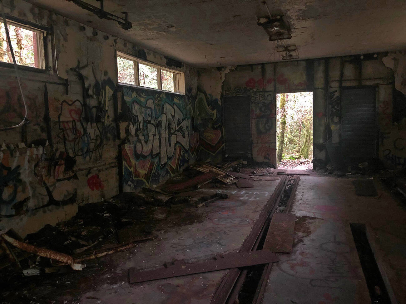
Explore the abandoned building partway to the Canso bomber wreckage site, or skirt around the outside if you’re not in the mood to be spooked. Amy Attas photo.
How to get there
While the new multi-use trail connecting Tofino and Ucluelet (named ʔapsčiik t̓ašii, pronounced ups-cheek ta-shee) has made it easier to access the Canso bomber crash site, the trail is still unsanctioned by Parks Canada. Bring proper footwear for the extremely muddy trail, carry extra clothes for unexpected weather changes, and give yourself enough time to complete the hike before dark.
Drive to the lower Radar Hill parking lot (you’ll need a National Park day pass in order to park, as the hike is located inside Pacific Rim National Park), then walk back towards the highway and turn right onto ʔapsčiik t̓ašii. Before the paved multi-use trail was completed in spring 2022, hikers had to walk the highway shoulder and count telephone poles to find the trailhead. It’s much more pleasant along the forested ʔapsčiik t̓ašii, but keep to the side and watch out for cyclists.
After walking south for 900 metres you’ll reach a junction and head into the woods on your right. The trail climbs gradually but is still fairly smooth, wide, and easy to navigate. After about a kilometre you’ll reach an abandoned building covered in graffiti. Enjoy a spooky detour exploring the crumbling interior, or circle the exterior to stay in touch with the trees.
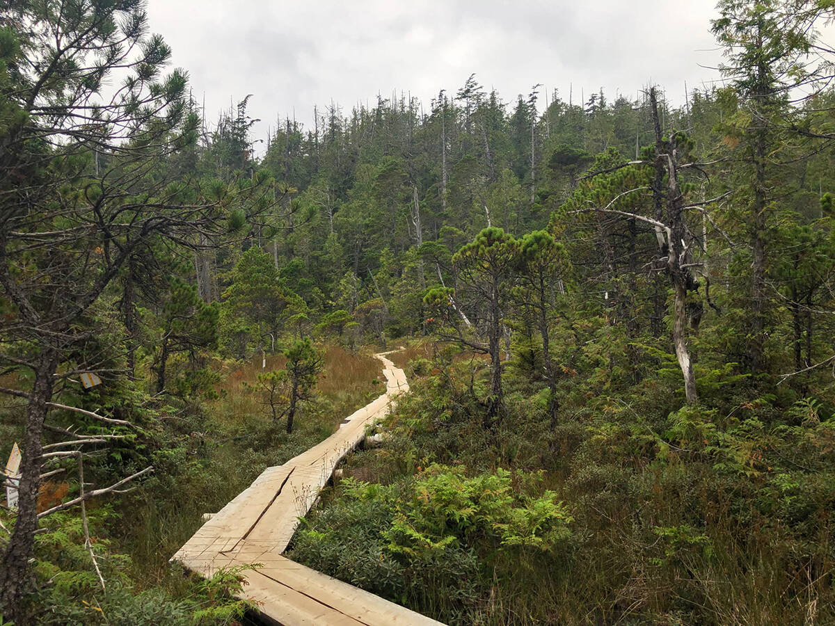
Wooden planks through the bog lay a trail to the Canso bomber near Tofino. Even in late summer the trail can be extremely muddy, so wear proper hiking boots. Amy Attas Photo.
After the abandoned building, the trail’s character changes dramatically. You’ll descend quickly, navigating over gnarled roots and following bits of flagging tape to stay on course. At the bottom you’ll enter a bog, which stays extremely wet and muddy even during the annual summer drought. Wear high-top hiking boots or gumboots, and expect to travel slowly as you negotiate the trail. A series of wooden planks have made it easier to steer clear of the mud, but not entirely.
You’ll know you’re close to the plane wreckage when you pass a perfectly circular pond, about the size of a car. Rescuers decided to detonate the plane’s bombs rather than carry them out, so the pond is your first glimpse at history.
It’s hard to describe the mix of feelings as the wreckage comes into view. For those of us lucky enough to avoid all first-hand experience of war, at first it feels more like stepping inside a movie than stepping back in time. I found myself thinking about Luke Skywalker and the Forest Moon of Endor, imagining Ewoks and tie fighters as I clambered around the first broken section of wing.
But up the trail a bit farther where the bulk of the plane has rested since the Second World War, my thoughts turned more somber. I thought not just of the crew, but also of the many hands who helped build this plane in Montreal. All that work on every rivet, only to have the hunk of metal lie dormant in the forest. What was it like to climb aboard one of these planes as a young soldier, not knowing where fate would take you? What kinds of missions did this plane undertake before landing in these woods?
These questions kept me company on the hike back (less than an hour each way). Then it was time to step into the 21st century, grab my board and play in the surf, feeling a little more grateful to be able to enjoy Tofino’s beaches recreationally, thanks to the efforts of pilot Ronnie Scholes and millions of others many years ago.
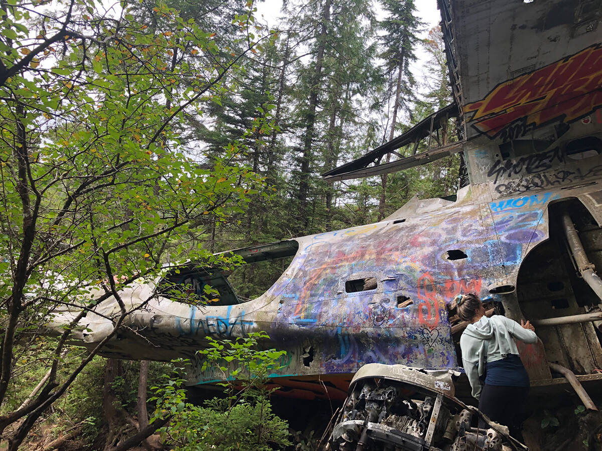
Seeing the Second World War plane up close brings history to life. Amy Attas photo.
Plan your adventures throughout the West Coast at westcoasttraveller.com and follow us on Facebook and Instagram @thewestcoasttraveller. And for the top West Coast Travel stories of the week delivered right to your inbox, sign up for our weekly Armchair Traveller newsletter!